


 19 / 22

19
Professional Land Surveyors of Oregon
|
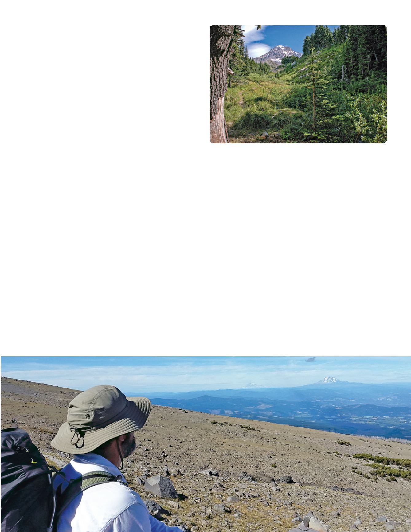
www.plso.orgPassing though Yocum Ridge, Cairn Basin, Eden
Meadow (right) and arriving the second night at Elk
Cove on the north side of the mountain. Here we
enjoyed a great sunset along with high winds that
probably approached 40 miles an hour for much of
the night.
Leaving Elk Cove, we passed through the burned
timber and headed for the difficult crossing at the
Eliot Glacier wash out. There are many creek and river
crossings on this trail that can be very treacherous
late in the day or in other times of high water. The
Eliot Glacier crossing has been very challenging for
the last few years and has been officially closed by
the Forest Service until later this year when a new
trail connection is opening. After a steep scramble
and finally finding a creek crossing point we arrived
at the Cloud Cap Inn. The Cloud Cap has its own
fascinating history, but digresses from the answer to
the original question of this column.
Leaving the Cloud Cap and continuing to climb, we
passed the historic stone shelter on Cooper Spur
at about 26 miles into our journey. Not long after
passing the shelter we arrived at the highest point
of the Timberline Trail at 7350 feet. Rather than the
quiet and forested trail of the first part of the trip,
the trail summit is an open pumice and lava slope
with huge vistas to the north, east and south of
the mountain (below). Beginning yet another steep
descent, this time down Gnarl Ridge, we arrive at
the answer to our original question. The Newton
Clark Glacier (photo on page 20) and the Newton
Clark Moraine comes into view on the southeast
side of the mountain. The moraine is the largest
glacial formation on the mountain, spanning nearly
three miles in length and containing an estimated
600 million cubic yards of material. According to
the Oregon Geographic Names book, Newton Clark
was an Illinois native who, after serving in the Civil
War, lived in South Dakota prior to making his way
to Hood River in September of 1877. He arrived in
Hood River with the outfit he drove over the trail from
South Dakota and $1.50 to his name. A teacher and
a land surveyor, he spent a considerable amount of
time exploring Mount Hood. From 1878 to 1886, he
fulfilled government contracts to survey many public
lands in the southern portions of Hood River county
and other areas within the northwest.
The Newton Clark glacier was named for him in 1886.
He died in Portland on June 21, 1918 and rests at the
Idlewilde Cemetery in Hood River.
At the base of Gnarl Ridge is Newton Creek which is
another treacherous creek crossing. We arrived late
in the day with the glacial melt running strong. After
a heart pounding crossing of Newton Creek we spent
our last night nearby at an elevation of 4700 feet and
prepared for another all day trek uphill to Timberline
Lodge. Continuing on our last day, we uneventfully
crossed Clark Creek and the White River early in the
morning when the glacial melt and water levels were
at their lowest.
continues >