


 19 / 22


19
Professional Land Surveyors of Oregon
|
www.plso.orgQ
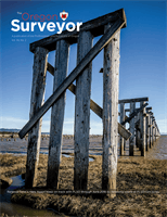
Located just south of Trestle Bay, can you name this shipwreck which is one of the most photographed
wrecks on the Oregon coast? It is located in a prized Oregon state park named for a “Lost Surveyor”
By Pat Gaylord, PLS
A
Lost Survey
o
r
The
Authors note
– In future issues I will be attempting to seek out Oregon landmarks and locations that have been touched by, named for or otherwise influenced
by “Lost Surveyors” in Oregon’s history. If you know of a locale you would like to see featured, please pass along the information.
The Peter Iredale ran aground in October of 1906
after missing the mouth of the Columbia River. As
one of the most accessible shipwrecks in the Pacific
it is a popular tourist attraction on the northern
Oregon Coast. The wreck is located in what is now
Fort Stevens State Park. This 3,700 acre expansive
state park offers Columbia River and Pacific Ocean
beach access, camping, fishing, hiking, miles of
biking trails and much more. In addition to the
Peter Iredale the park features World War II instal-
lations which are open to exploration and fun
for the family. Fort Stevens was an active military
installation from 1863 until its closure in 1947. The
fort was shelled by a Japanese submarine during
World War II, but it suffered no damage during the
attack. This attack makes it the only military instal-
lation in the continental United States to come
under enemy fire since the War of 1812. Ironically,
this Oregon State Park is named for the first
Governor of the Washington Territory, Isaac Ingalls
Stevens, who served from 1853–1857.
A governor, Congressman, and Brigadier General
in the Union Army, he is also this issues “Lost
Surveyor.” Although limited in duration, his
continues on page 20 >