


 18 / 22

The Oregon Surveyor
|
Vol. 39, No. 5
18
BLAST
<<<<<<<<<
PAST
from the
Dec/Jan 2005-2006
December 2005/Ja uary 2006
there was a sawmill and houses in the township record, but
no record of the Lewis and clark corps of Discovery 1805
Fort clatsop. there was mention of rolling hills, good soil,
swampy areas, prairie, the clatsop Plain, good pastures,
and trees and shrubs. there was a slough for transportation,
and the river emptied into Young’s Bay. President Jefferson
asked Lewis and clark to do some of the things surveyors
are asked to do; record the land, soils, etc. the area was also
examined for settlement and future potential; some of the
same goals that still exist in surveying today.
replicas of the dedicated monument were presented to
sue newstetter and chip Jenkins. ken Wightman of David
evans & associates, and a descendant of the original ex-
pedition party, worked very hard on the project and PLso
helped extensively with the project. Lloyd tolbert attended
the setting of the first monument in Washington, Dc and
was also present at netul Landing.
With the dedication of the corps of Discovery ii monu-
ment complete the next endeavor of the day was to hike the
Fort to sea trail, which several PLso people had helped to
construct. the trail’s grand opening was included in the
bicentennial festivities of november 11-14, 2005. the trail is
a congressionally approved project which starts in the Fort
clatsop area and ends approximately six-and-a-half miles
later at sunset Beach. Volunteer labor was used extensively
in the building of the trail.
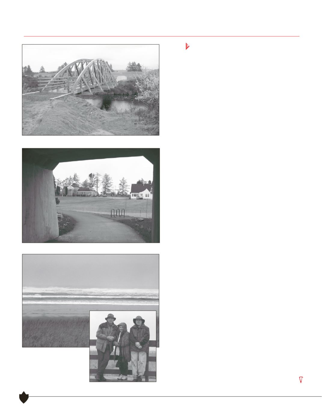
recounting the hike of the Fort to sea trail, oran abbott
related that the trail has a diversity of flora and fauna. it
starts in a typical coastal forest, then follows an old logging
road uphill for about a mile until it reaches a high point of
about 350 feet. an overlook located at this point was not
complete on this day. the trail then goes downhill into a
swampy creek area. it follows the creek drainage for awhile
then continues over a small hill. next it follows some hedges
near pastures and continues through a highway 101 under-
pass. the trail winds past a historical church and several
fields, over a floating bridge, uphill to a golf course, then
turns and crosses over a large bridge. From there it goes
into shore pine, and reaches the sunset Beach parking lot.
the trail continues another third of a mile to the sunset
Beach overlook where one can see expansive views of the
Pacific ocean.
our day closed with a view of the ocean from the trail’s end
viewpoint deck in drizzling rain. Lewis and clark also ended
numerous of their winter days at Fort clatsop in the rain.
Unlike them, however, we chose to stay in oregon, preferring
the end of their journey, in the “oregon country: the new
eden” (as it was marketed to the settlers) to life back east.
A beautiful wooden bridge crosses the slough.
The trail passes under Highway 101.
The trail ends at an expansive
viewpoint deck overlooking
the Pacific Ocean.
It’s the Abbotts and Nick
Miller, the photographer.
Continued