


 17 / 22

17
Professional Land Surveyors of Oregon
|
www.plso.orgBLAST
<<<<<<<<<
PAST
from the
Dec/Jan 2005-2006
The Oregon Surveyor
4
an noaa speaker, wearing the dignified surveying attire
of the era, made an excellent presentation regarding histori-
cal surveying in the region using authentic equipment. the
speaker stated that there were good maps and information
for the east coast, but the area between the east coast and
the west coast was basically blank. there was some mapping
of the coast here. We now have amazing technology and we
have made great advancements.
according to Dick Bicklen of the BLm’s general land office
surveys, the surveys of 1856 gLo showed grid maps before
settlement and squatters. the townships were set in squares
six miles wide, like a checker board. the speaker said we
were located in township 8n, range 10W. a fancy compass
had degrees and half degrees and was used along with a
Jacob staff (which goes into the ground until measurement
is stable), and a chain for measuring length. the men would
line up, then sight and get straight lines. they would keep
records of surveys and record them; measuring distances
of one mile at a time. they used a precision measurement
device, 66 feet long for measuring a mile, 7.92 inches in each
link, measuring chains and links, with 100 links per chain.
they would swear (by raising their hand) to do an accurate
job. the chain was to be kept tight and level with the aid
of a front and rear chainman. they also started using half
chains (33 feet); it took 160 times to measure a mile! When
on line, they would drop the pin at the end of the chain for
the marker. after chaining pins, they would measure the
next section by walking forward. they “stick, stuck” in the
sequence staking process, measuring ten miles a day with
a daily pay of $1. they also established where the section
corners were located. the axeman cut a clear line. then they
made a post from a tree, measured four feet of it, took off the
branches, and used an axe to square it off by taking off the
sides. they put the post in the ground, positioning it cor-
rectly. Directions were carved into the post with a scribing
tool, which told the exact position of the section corner.
to find and purchase available land settlers would go to
the land office. Purchasers would look at the land to see
if there were trees to use for buildings and fencing. they
also wanted to study the land next to their property. some
settlers would move the posts and claim the land. the land
office knew the correct location of the property line. they
would choose a mature tree, blaze it by the axeman, carve
the information into the tree—which then became the re-
corded bearing tree for use in measurement—and write the
details into the record. the posts would rot away quickly,
while the bearing trees would be around for a long time. the
type of tree and measurements were clearly noted. in 1856
Netul Landing, cont.
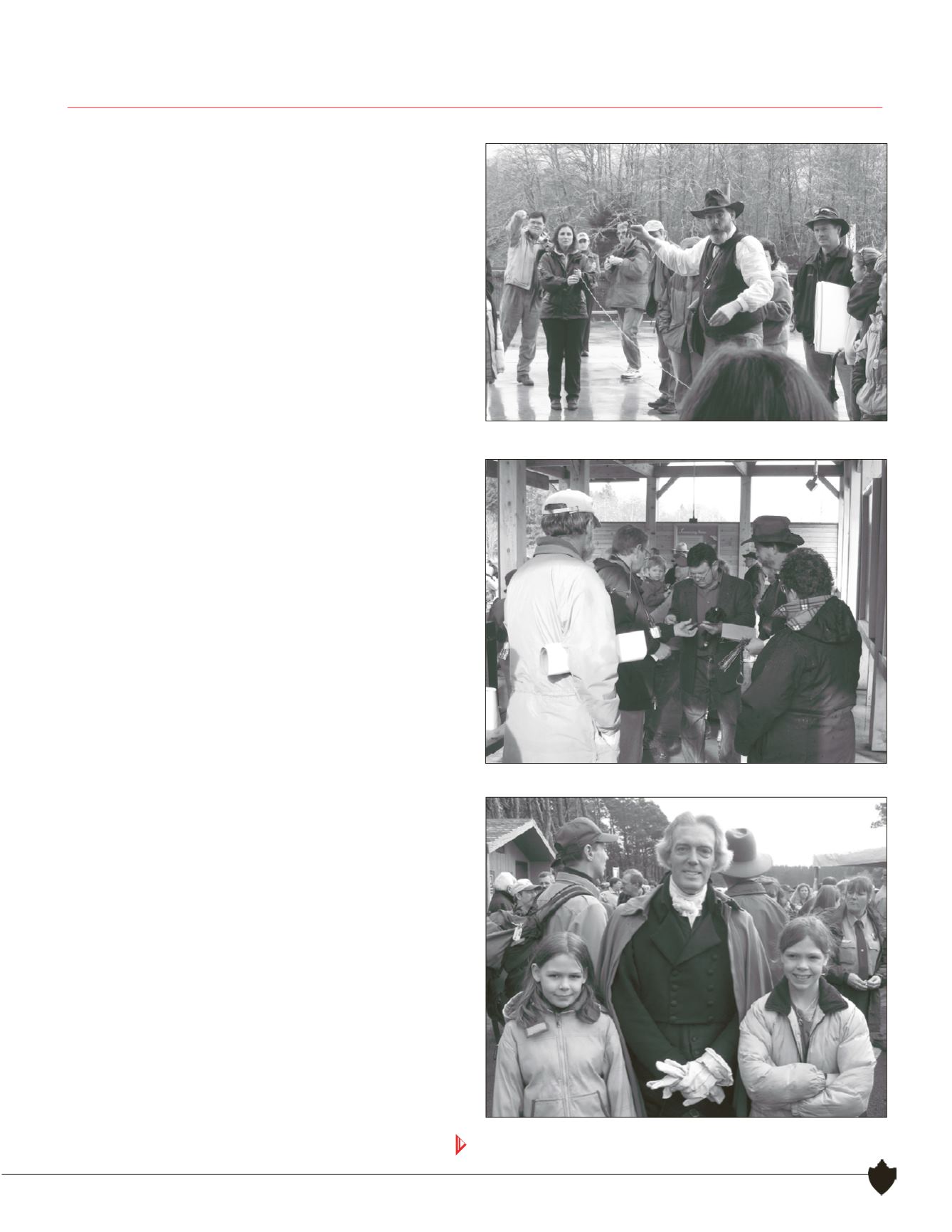
Lloyd Tolbert and Mary Hartel demonstrate chaining.
President Thomas Jefferson (actor Bill Barker) is flanked by Lloyd
Tolbert's daughters. Could they be future surveyors?
Tim Kent and Sue Newstetter peruse the exhibits.
Continues