


 15 / 22

15
Professional Land Surveyors of Oregon
|
www.plso.orgA
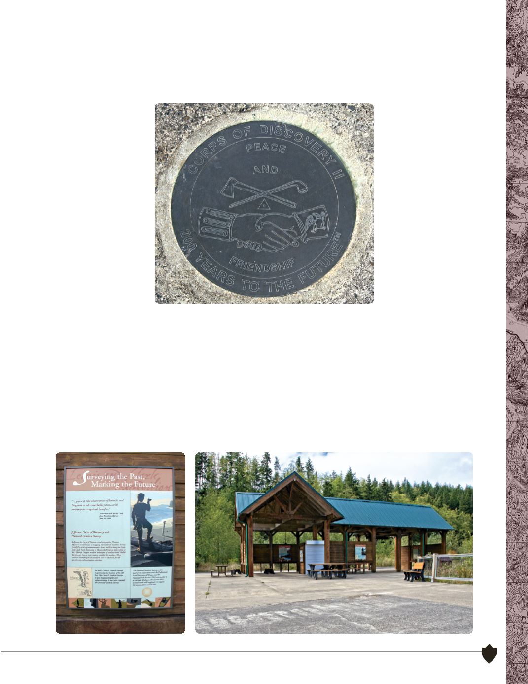
If you have been a member of PLSO for a while, you may recognize this spot as one of the major
contributions of PLSO to the Oregon public. Located at Netul Landing in the Fort Clatsop National
Historic Park, this brass disk was placed through the cooperation of PLSO, LSAW, the National
Geodetic Survey and the National Park Service to commemorate the 200th anniversary of the
Corps of Discovery.
A similar disk was placed on the Washington side of the Columbia at “Station Camp”, the site of the
first camp established by Lewis and Clark prior to moving to Fort Clatsop.
Located on the Netul River, which is now known as the Lewis and Clark River, this canoe-landing
site represents the end of the Lewis and Clark river trail. The landing is just south of historic Fort
Clatsop and although it had many other uses through history, it is now preserved as a part of the
park. The monument was dedicated on a rainy day in November of 2005 (see the Blast from the
Past article on page 18) and was attended by a number of PLSO members and local dignitaries.
The disk and interpretive signage remains in good condition and continues to educate the public
about a small piece of what we do. This was a project that all PLSO members can be proud of.
While visiting this site you can also explore the 10 mile Fort to Sea Trail, which received many other
PLSO survey contributions during this same time period.